Many long-term, large-budget projects such as mining operations would realize tremendous cost benefits and improved efficiency and safety from Project Lifecycle Surveys. Based on the concept that the completion of high-accuracy surveying and mapping at the initial stages of a project and utilized throughout the entire project lifecycle, leverages costs and benefits from superior, comprehensive survey information throughout the project lifecycle.
Lifecycle Surveys Provide Superior Information and Reduced Costs
The availability of common data from project inception permits better planning and stage evolution. The cost of surveying and mapping experienced through various stages of a mining project lifecycle: planning, engineering, construction, maintenance and ultimately project area remediation on shut down, can be greatly reduced by efficient use of survey services extending beyond individual phase requirements. The use of a common database reduces the possibilities of data discrepancies and errors due to different mapping standards, datum parameters and collection techniques. The project mapping database incorporates standards that address the highest quality required for all stages of development and related disciplines using the data.

The second benefit is a recognized reduced cost. These cost reductions are evident in vendor RFP responses due to risk reduction by way of more and better bid information available for subsequent phase requirements. The cost reduction also extends into the subsequent phases by leveraging the preceding phases base map data and only acquiring new or differential data in the areas in which change is expected or concerned.
A tertiary benefit is improved overall timeline for the subsequent phase planning and implementation. If base map data is acquired at an accuracy and coverage level conducive to meet the highest phase, this planning for the phase can happen well in advance of the actual sequential timeline typically implemented in a project’s lifecycle.
There will be cost reductions associated with the elimination of redundant surveying and mapping services for each phase of the project. When developing a site, it is not uncommon for survey crews to be sent out multiple times to determine and survey preferred routes for roads, pipelines, drill sites and other infrastructure…this can easily lead to multiple surveys for a particular road or pipeline and there are numerous occasions for these surveys throughout a project lifespan. These surveys can add up to tremendous costs …not to mention the risks of sending crews out to hazardous, severe environments.
The utilization of a comprehensive, detailed, accurate survey using airborne LiDAR and ortho photos provides an accurate, detailed base-map from which all preconstruction design and engineering can be done in the office by computer using CAD and GIS software. Lifecycle Surveys eliminate redundant, expensive surveys, improve safety by sending fewer crews onsite to survey treacherous and inaccessible terrain, and improve decision making by utilizing the best, most accurate data for the project area. The coordinated data set will also eliminate costly remediation tasks experienced in survey discrepancies between project stage transfers.
Ideally, Lifecycle Surveys are initiated prior to project planning and engineering. It involves the establishment of high-accuracy survey control networks, which would be coordinated with the local government survey authority (where available) and would also incorporate data tie-in aspects with the local cadastral database or information on land ownership and usage. This network would provide the fundamental survey control for the entire project and would be established in such a manner to provide stable and confident reliability and accuracy so as to promote future project area expansion, internal densification and re-establishment of disturbed points.
These networks provide the terrestrial tie points used in all other surveying and mapping procedures. The next phase of the database would be to establish high-confidence DTM surface models and AM/FM feature models for the area using a technology appropriate for the project criteria. These mapping efforts may be implemented in a staged approach, as the requirements for mapping will likely be stage dependent. This approach also lends itself to maximize the usability of the data and the current technology for the project. All surveying and mapping efforts are coordinated using a unified database, thus access, distribution and database updates can be easily implemented.
Aerial LiDAR surveys have proven to be a valuable, critical element for Lifecycle Surveys. Aerial LiDAR is accepted as the most efficient and cost-effective means to create accurate digital elevation, terrain and topographic surveys. The latest LiDAR technology is able to create very accurate 3D point clouds from which final deliverables are extracted such as contours, Digital Terrain Models (DTM), Digital Elevation Models (DEM), topographic features, planimetrics, 3D facility models, as-built drawings and detailed, accurate volumetric data.
Overview of LiDAR Technology
Mining projects have taken LiDAR Services International (LSI), Calgary Alberta; and LiDAR Services, LLC, Las Vegas Nevada to three continents and a wide range of environments, from the boreal forest and plains of Canada to the jungles of Borneo and Madagascar. LSI designs and manufactures their own proprietary LiDAR systems and has produced 6 generations of airborne sensors over the past 25 years. During the evolution of LiDAR systems, LSI has developed a modular approach in both the software and hardware sensor integration which easily facilitates the customization of the system into an integrated set of sensors applicable to their clients’ project requirements and budgets.

LSI’s latest generation of LiDAR systems is called MATRIX and supports a variety of inertial sensors, scanning lasers, GPS receivers/antennas, and digital frame/digital video cameras. These sensors are mounted on Canadian DOT STC and US FAA STA approved installation kits for the Bell 206B and 206L helicopters and Cessna 185F and Partenavia P68 aircraft. LSI typically installs in locally chartered aircraft to minimize mobilization costs and ferry time.
” Lifecycle Surveys have been a critical element of our operational experience and lending itself to our corporate service of not just delivering requested mapping products, but assisting our clients in their understanding of their project needs,” said Tony Tubman, president, LiDAR Services International (LSI). “As a LiDAR system developer and service provider, we take great pride in our understanding and real world experience of the technology involved in aerial remote sensing and our ability to provide innovative solutions beyond the mapping data set.”
Traditionally, LSI’s mining surveys have involved typical DTM and volumetric mapping, but recently they have performed time-sequenced topographic modeling to facilitate subsidence monitoring, and precision slope determination for ore slurry pipeline engineering. LSI is committed to the technological advancements of LiDAR and remote sensing integration. The recent addition of the latest waveform scanning technology is a testament to the leading edge position LSI maintains in the LiDAR industry. Many of their projects also implement ortho-mosaic imagery to assist in engineering analysis of the project areas.
LiDAR Benefits Madagascar Nickel Mine
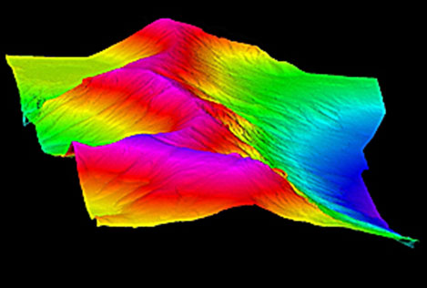
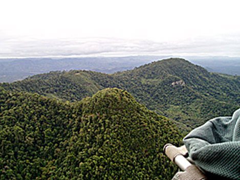
The Ambatovy Nickel mine in eastern Madagascar for Dynatec Corporation was a particularly challenging mining project. LSI was contracted by Dynatec Corporation to provide surveying and mapping services to support the route planning and development of a nickel mine in Madagascar. Because much of the project area was located in remote mountainous jungle, the project required the establishment of a GPS control network in order to provide an accurate DEM and 15cm orthophotography for the entire project area.

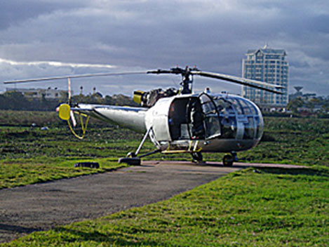
The rugged terrain, dense vegetation, and weather patterns presented a unique challenge to the LSI survey team. The MATRIX LiDAR system installed in a local helicopter was able to fly below the clouds and collect data when other high altitude fixed wing LiDAR systems would have been waiting for better weather.
LSI delivered a bare earth and full feature DEM, high resolution orthophotography, and contours for the proposed mine site, ore processing plant site, and connecting slurry pipeline route. The area covers approximately 300km2 and hundreds of kilometers of pipeline route over difficult terrain varying from mountainous jungle to coastal flood-plain. The data is being used to locate sites for facilities, select pipeline routes, and minimize and evaluate environmental impacts.
The pipeline route surveying was of key concern as the undulating, densely-forested, upland terrain made traditional surveying techniques nearly impossible from an access and accuracy perspective. The critical nature of this was the pipeline slope gradient.
“The slurry mass and velocity characteristics were such that a precise slope gradient needed to be designed and constructed such that the slurry mass and velocity would be predictable and controllable with minimal risk and facility cost,” said Tubman. “If the survey terrain accuracy was not at the level expected by the pipeline design engineers, then several undesirable situations could arise, such as; runaway slurry masses stressing pipeline integrity, additional lift or pump station facilities may be needed along route in difficult access areas or potential slurry solidification in the pipe resulting in complete facility remediation.”
Conclusion
Aerial LiDAR surveys can benefit all phases of project development as part of an integrated Lifecycle Survey. For mining applications they assist in planning, managing, evaluating, analyzing, and improving mining operations to optimize performance and enhance return on investment: From scoping level to active operations through to site closure,
High-density, highly accurate LiDAR point-clouds provide rich survey data for detailed designs for open-pit slopes, waste dumps, rock piles, earth dam structures, slope stability assessments and provides valuable survey information for the design of earth structures, mine waste management, monitoring programs, mine closure planning, and tailings management. Remote sensing data can also be used for construction material suitability studies, optimizing the use of mine waste for construction.
The time, effort and expense involved in surveying and mapping requirements of most large-scale projects is high and downstream effects may be costly. The unification of these actions into a single continual, controllable phase will reduce cost, effort and errors. These factors make it an appealing alternative to individual survey and mapping contracting. Additionally, access to highly accurate, detailed LiDAR and orthophoto data provides superior information and situational awareness that can materially impact operational and safety benefits to all aspects of mining operations.
About LiDAR Services International Inc.
LiDAR Services International (LSI) is a leader in airborne LiDAR services, performing engineering level LiDAR surveys across the globe from the high-Arctic to the jungles of Borneo, operating two helicopter-based LiDAR systems and one fixed-wing system. LSI recently opened their US subsidiary, LiDAR Services, LLC located in Las Vegas, Nevada. LSI celebrates 10 years of operations in 2012 and has provided specialized expertise in collecting high-density, highly accurate LiDAR and imagery data for mining, forestry, oil, gas, pipeline, engineering and electric transmission customers. What differentiates LSI from other mapping companies is their single-minded commitment to their client’s project, their unequalled experience, knowledge, technical expertise, innovation and customized service ensures their client’s complete satisfaction on every project.
